Delegations
FERROL
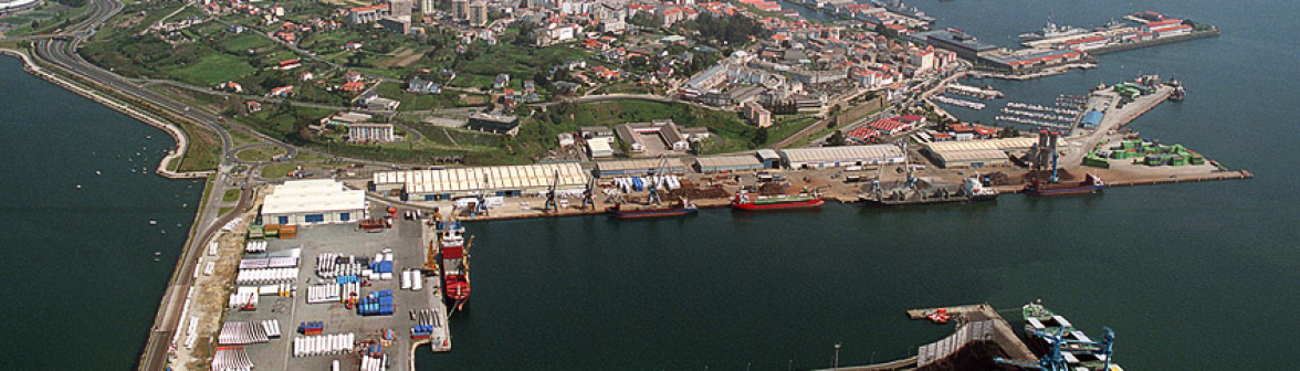
OUTER HARBOR OF FERROL
General characteristics
- Breakwaters with sloping faces: 1,067 m long.
- Ribera dock: 1,515 m and 20 m deep.
- Auxiliar dock: 145 m long and 10 m deep.
- Land surface area: 89.3 ha.
- Seawall-adjacent hammer system for the mooring of auxiliary ships.
Individual Information
- · Container Terminal
Licensee: Ferrol Container Terminal
Storage Surface Area: 300,000 m2 - · Coal Terminal
Licensee: Endesa Generación, S.A.
Storage Surface Area: 100,802 m2 - · Biodiesel Terminal
Licensee: Masol Iberia
Storage Surface Area: 41,232 m2
- Storage Warehouse
Port Authority
Storage Surface Area: 25,260 m2 - Electricity Substation
Licensee: Unión Fenosa
Storage Surface Area: 1,198 m2 - Waste Treatment Terminal
Licensee: Procesoil
Surface area: 3,000 m2
Dock depth: 14 m
Uncovered surface area: 35,102 m2
A CORUÑA
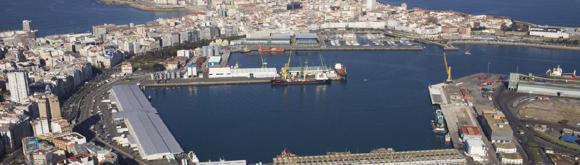
Oil port
- Third jetty
Depth: 16 m. - Second jetty
Depth: 11 m. - First jetty
Depth: 11 m.
General cargo
- San Diego Dock
Length: 549 m.
Depth: 10 m. - South Centenario Dock
Length: 385 m.
Depth: 11 m. - North Centenario Dock
Length: 638 m.
Depth: 16.5 m. - South Calvo Sotelo Dock
Length: 420 m.
Depth: 6 - 9 m. - Transatlantic Dock
Length: 484 m.
Depth: 11 m. - Batería Dock
Length: 220 m.
Depth: 7 - 8 m.
Outer Harbor
- Area of operations
Surface area: 6.7 ha. - Solid bulk - General goods
Surface area: 19 ha. - Surface Area Available
Surface area: 60 ha.
SAN CIPRIÁN
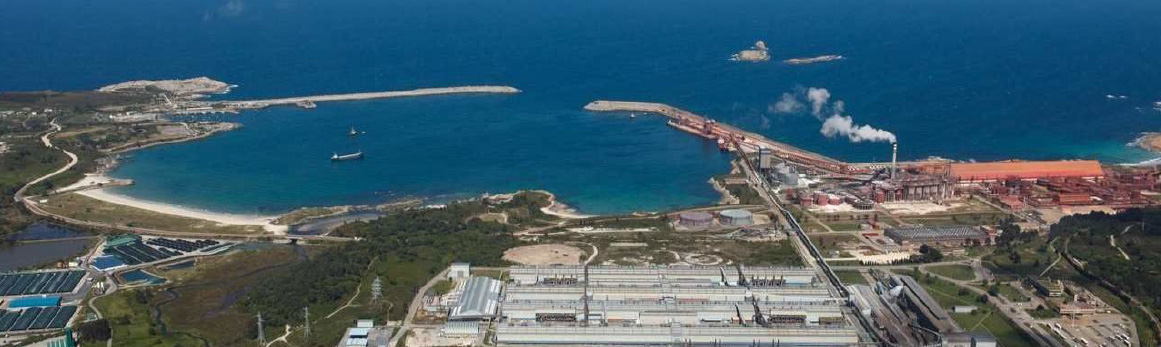
LOCATION
- Longitude: 7º 28’ W
- Latitude: 43º 43’ N
- Dominant: NE-NW
- Dominant: NE-SW
- Maximum tide range: 4.59 m
- Height of LLW to port zero: 0.00 m
- Height of MMW to port zero: 4.59 m
- Width: 200 m
- LLW water depth: 17 m
- Seabed: Sand and rock
- Length: 1,800 m
- Width: 200 m
- LLW water depth: 17 m
- Seabed: Sand
- Length: 2,300 m
- Orientation EW
- Width: 270 m
- LLW water depth: 20 m
- Maximum controlled current: 4.5 knots
FLOATING SURFACE AREA
- Area I: 41 ha.
- 563.456 m2
- Main Dock:
Mooring line measuring 232 m and 17-14m deep - Auxiliary Dock:
Mooring line measuring 88 m and 7 m deep - Service Dock:
Mooring line measuring 45 m and 5.4 m deep
- Norhtern Seawall: 935 m